
Summary:Scientists have investigated the causes of a glacial lake outburst flood in the Ladakh region of India. They drew on field surveys and satellite images to create an inventory of glacial lakes for the Trans-Himalayan region of Ladakh, identifying changes in the size and number of glacial lakes, including undocumented outburst floods. The inventory aims to improve risk assessment for future events.
Researchers from the South Asia Institute and the Heidelberg Center for the Environment of Ruperto Carola investigated the causes of a glacial lake outburst with subsequent flooding in the Ladakh region of India. In order to frame the case study in a larger picture, the research team led by geographer Prof. Dr Marcus Nüsser used satellite images to create a comprehensive survey of glacial lakes for the entire Trans-Himalyan region of Ladakh. They were able to identify changes in the extent and number of glacial lakes over a 50-year period, including previously undocumented floods. This analysis allows them to better assess the future risk of such events, known as glacial lake outburst floods (GLOFs).
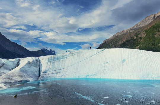
“In the wake of global glacier shrinkage caused by climate change, the danger from glacial lake outburst floods is seen as an increasingly pressing problem,” explains Prof. Nüsser of the South Asia Institute. An event like this unleashes huge amounts of water. Flash floods, for example, can wreak havoc on villages, agricultural areas, and infrastructure. To find out more about such events, the Heidelberg researchers studied a glacial lake outburst flood in Ladakh that destroyed houses, fields, and bridges in the village of Gya in August of 2014. Studies of the glacial lake, which is situated at 5,300 m above sea level, revealed a drastic short-tem lake level rise prior to the GLOF.
The cause, as the scientists discovered, was a “previously little-known mechanism.” “Increased glacial melting caused the lake level to rise quite rapidly. Instead of resulting in spillover, however, the thawing ice cores in the moraine, i.e. the glacier’s debris field, drained through subsurface tunnels without disturbing the moraine’s surface,” states Nüsser. In addition to conducting field surveys, the scientists also interviewed the locals about their recollections of the GLOF event. On the basis of satellite images, the team additionally studied the evolution of the glacial lake since the 1960s in order to reconstruct possible GLOF events.
“The high temporal and high spatial remote sensing imagery from satellites supported by field surveys will allow us to better assess the possible risk of future outbursts in this region,” adds the Heidelberg geographer. In light of recurring GLOFs, the new inventory can help us “re-evaluate the hazards, identify vulnerable locations, and develop possible adaptation measures,” continues Nüsser. After the flood in Gya, for example, concrete walls were constructed along the undercut bank as a flood protection measure to safeguard the villages and fields from future floods.
More: Science Daily